
McMurdo Station: a long way from home!
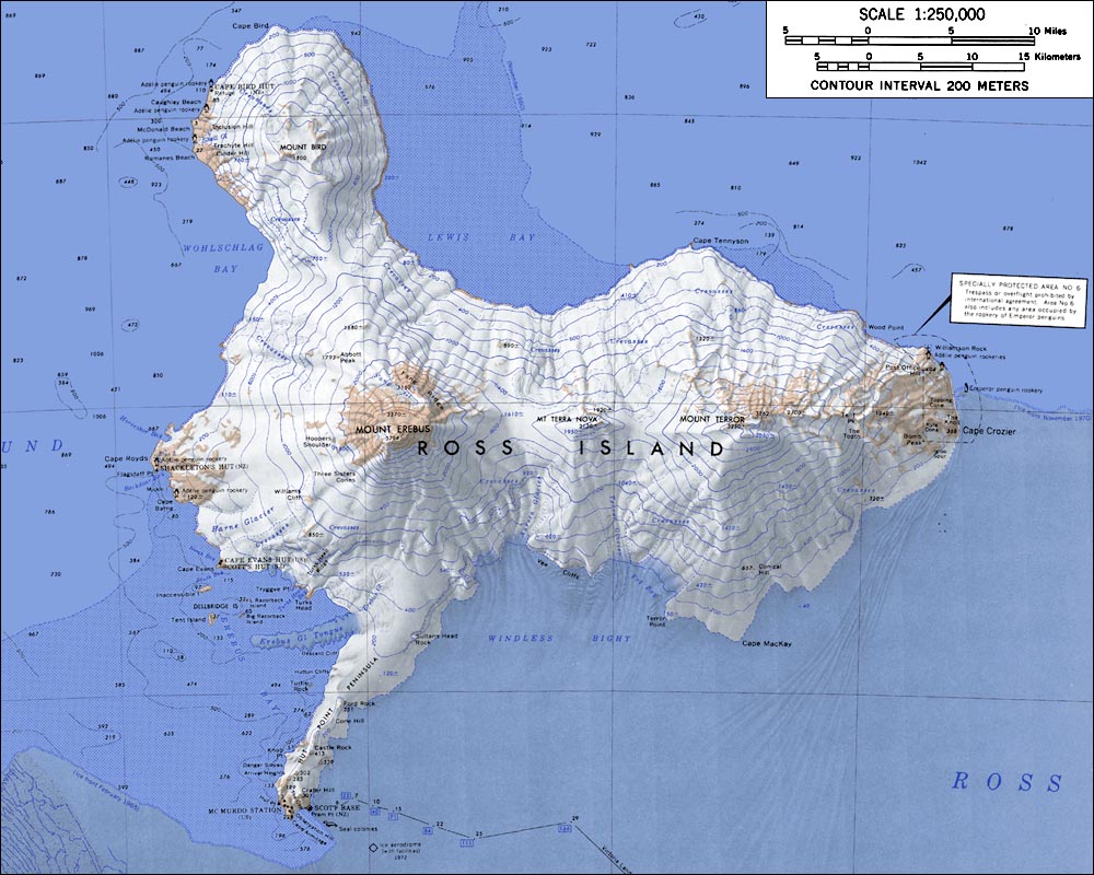
McMurdo Station is on Ross Island, which lies in the Ross Sea, just north of the Ross Ice Shelf. All of this is on the continent of Antarctica, south of New Zealand.

can you find the Ross Ice Shelf?
Maps of Antarctica are interesting and in a way difficult to read, because north is not just up! From the South Pole, north is all directions. From McMurdo Station, and Ross Island, the South Pole is south, even though, on these first two maps, at first glance it looks like it might be north!
Ross Island, in the map below, has been rotated in relation to the previous maps so that north is up (south pole would be down!). McMurdo Station is on the southern tip of the island- Hut Point Peninsula. Mt. Erebus is the snow-covered active volcano on the island- you can see it smoking most days.
This detailed map of the Hut Point Peninsula gives you an idea of how close everything is here. Ob(servation) Hill, the local quickie hike, is at the southern-most tip. Scott Base, on the eastern side of the peninsula, is the Kiwi Base. The creme-colored area to in the south-east corner of this map is a permanent ice shelf: the Ross Ice Shelf. The south-west corner of the map is where the annual sea ice is- this is where the Ice Runway is for the beginning of the year.

Rumor has it that the ice break up is closer in than it usually is, meaning that the entire McMurdo Sound may break up, and whales could be spotted right off the coast of Ross Island- just outside our dorm room window!


1 comment:
I noticed on the last map, that there is a seal colony not far from where you guys are... Do you ever mix it up with the Seals? I mean, what's a colony like? Do they have their own roads and stuff? Community events? Wow! A seal colony. Cool.
Post a Comment